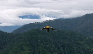
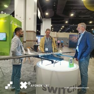
ideaForge Technology Limited, a global leader in unmanned aerial vehicle (UAV) technology, has announced the launch of its Q6V2 GEO, the company’s most versatile mapping drone to date. The official unveiling took place at PRAGYA 2025, ideaForge’s inaugural customer event, centered on the theme “Advancing Possibilities in Geospatial Intelligence.”
A Leap in UAV Innovation
The Q6V2 GEO represents a significant milestone in India’s rapidly evolving UAV industry. Designed to operate across diverse terrains, from Himalayan glaciers to dense forests and urban landscapes, the drone is engineered for survey-grade precision and mission-critical intelligence gathering.

Performance and Payloads
Weighing under 7 kg, the UAV offers 50+ minutes of flight time with LiDAR payloads. Equipped with advanced IMU, PPK-enabled geotagging, and CORS integration, it ensures exceptional accuracy. The system supports five modular and third-party payloads, including:
- 61 MP AI-enabled SHODHAM M61 camera for high-resolution photogrammetry
- LiDAR systems for terrain mapping
- Oblique imaging and hyperspectral sensing
- Thermal detection for industrial and environmental monitoring
Paired with Flyght Cloud, ideaForge’s secure cloud-based analytics platform, the UAV converts raw data into decision-ready intelligence.

Multi-Sector Applications
The Q6V2 GEO’s versatility positions it as a transformative tool across industries:
- Urban Planning: 3D city modeling, infrastructure audits
- Mining: Automated compliance, volumetric analysis
- Utilities: Power tower inspections, vegetation risk assessment
- Agriculture: Crop stress detection, yield optimization
- Forestry & Water Management: Biomass and habitat monitoring
- Disaster Response: Rapid terrain assessment in remote and high-altitude regions
Strategic Significance: Strengthening India’s UAV Leadership
The Q6V2 GEO strengthens ideaForge’s standing in the global UAV market while advancing India’s leadership in geospatial intelligence and smart governance. Its applications extend from avalanche prevention studies in the Himalayas to archaeological preservation of Konkan petroglyphs, reflecting the technology’s societal and scientific impact.
“The Q6V2 GEO, along with our geospatial tech stack, is a leap forward in geospatial intelligence,” said Ankit Mehta, CEO of ideaForge. “From mapping glaciers to surveying urban corridors, we are delivering solutions that unlock missions once thought impossible.”


